Map Slavičín
Basic map data
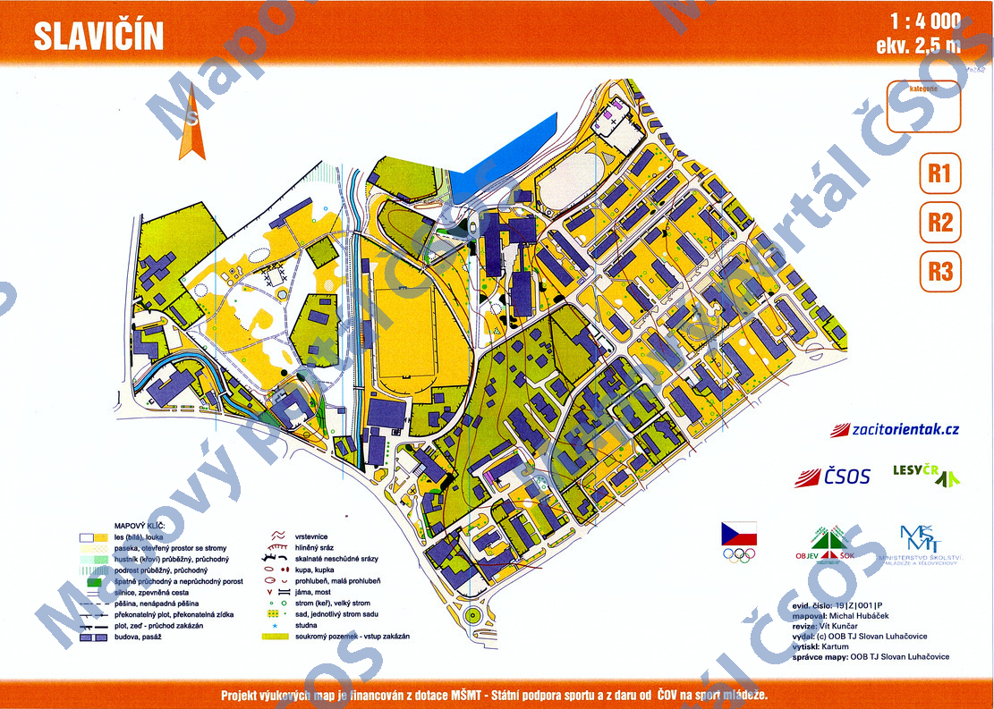
| Scale | 1:4000 | Equidistance | 2.5m | Sport | Foot-O/print | Specification | ISSprOM (sprint foot-O) |
|---|---|---|---|---|---|---|---|
| Year | 2019 | Published by | OOB TJ Slovan Luhačovice | Filing number | 19Z001P | ||
| Blocking until | 2028 | Blocking reason | |||||
| Map admin | Libor Slezák | Publisher | LCE - OOB TJ Slovan Luhačovice | Educational map | ano | ||
| Locality | Slavičín | Kraj | Zlínský kraj | Area size | 0.297 km2 | ||
| Based on | ortofoto | Stav | 2018 | Drawing technique | OCAD 10 | ||
| Printed in | Kartum | Print technique | 8 colors | ||||
| Note (public) | OBJEV ŠOK. | ||||||
| Entry created by | Marek Cahel | Archive | aaa0 | ID/status | 10208 / archived | ||
Autoři
| Name | Role |
|---|---|
| Hubáček Michal | mapped |
| Kunčar Vít | revised |
Obrys mapy
Map preview
Using the map without publisher's permission for organized events is copyright piracy. Please contact the map administrator listed in the Map Archive database and obtain maps in full quality for printing.
Našli jste problém v záznamu (nesprávné nebo chybějící údaje, špatný obrys)? Budeme rádi, pokud nám o tom řeknete.