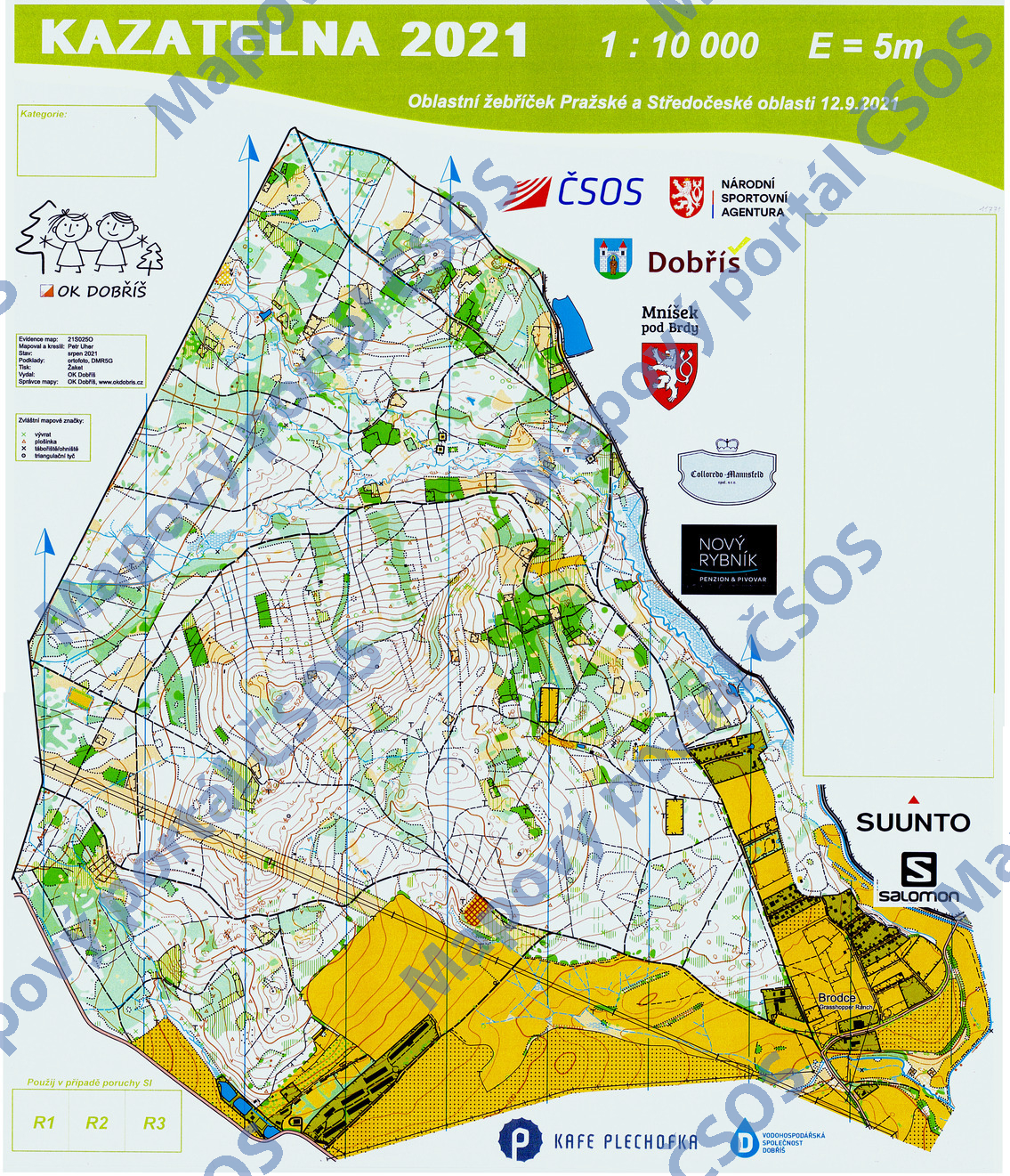
Map Kazatelna 2021
Basic map data
| Scale | 1:10000 | Equidistance | 5.0m | Sport | Foot-O | Specification | ISOM (foot-O) |
|---|---|---|---|---|---|---|---|
| Year | 2021 | Published by | OK Dobříš | Filing number | 21S025O | ||
| Blocking until | 2030 | Blocking reason | |||||
| Map admin | Jindřich Houska | Publisher | DOR - OK Dobříš | Educational map | ne | ||
| Locality | Dobříš | Kraj | Středočeský kraj | Area size | 5.321 km2 | ||
| Based on | ortofoto, DMR5G | Stav | 2021-08 | Drawing technique | OCAD 2018 | ||
| Printed in | Žaket | Print technique | laser | ||||
| Main race (title) | Oblastní žebříček | Main race (date) | 2021-09-12 | ||||
| Entry created by | Jindřich Houska | Archive | aaa0 | ID/status | 11771 / archived | ||
Autoři
| Name | Role |
|---|---|
| Uher Petr | mapped, drew |
Obrys mapy
Map preview
Using the map without publisher's permission for organized events is copyright piracy. Please contact the map administrator listed in the Map Archive database and obtain maps in full quality for printing.
Našli jste problém v záznamu (nesprávné nebo chybějící údaje, špatný obrys)? Budeme rádi, pokud nám o tom řeknete.