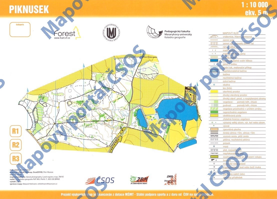
Map Piknusek
Basic map data
| Scale |
1:10000 |
Equidistance |
5.0m |
Sport |
Foot-O
|
Specification |
ISOM (foot-O)
|
| Year |
2018
|
Published by |
Katedra geografie PdF MU, Poříčí 7, 603 00 Brno |
Filing number |
18J005O |
| Blocking until |
2027 |
Blocking reason |
|
| Map admin |
Eduard Hofmann
|
Publisher |
ZBM - SK Brno Žabovřesky
|
Educational map |
ano |
| Locality |
Moravec (Velké Meziříčí 13sv) |
Kraj |
Kraj Vysočina |
Area size |
1.515 km2
|
| Based on |
ortofoto, KM, ZM 10 |
Stav |
2018-04 |
Drawing technique |
OCAD
|
| Printed in |
Žaket Praha |
Print technique |
8 colors
|
| Note (public) |
OBJEV ŠOK, bez loga. |
| Entry created by |
Libor Zřídkaveselý |
Archive |
aaa0 |
ID/status |
9830 / archived |
Autoři
Obrys mapy
Náhled
Using the map without publisher's permission for organized events is copyright piracy. Please contact the map administrator listed in the Map Archive database and obtain maps in full quality for printing.