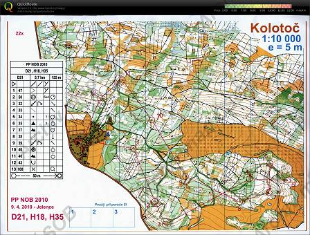
Map Kolotoč
Basic map data
| Scale |
1:10000 |
Equidistance |
5.0m |
Sport |
Foot-O
|
Specification |
ISOM (foot-O)
|
| Year |
2010
|
Published by |
- |
Filing number |
- |
| Blocking until |
0 |
Blocking reason |
|
| Map admin |
-
|
Publisher |
FSP - VSK ČVUT Fakulta Stavební Praha
|
Educational map |
ne |
| Locality |
Obory (Příbram 15v) |
Kraj |
Středočeský kraj |
Area size |
3.815 km2
|
| Based on |
- |
Stav |
- |
Drawing technique |
OCAD
|
| Printed in |
- |
Print technique |
|
| Note (public) |
Jen JPG. |
| Main race (title) |
Přebor Prahy NOB
|
Main race (date) |
09. 04. 2010 |
| Entry created by |
archiv ČSOS |
Archive |
c--0 |
ID/status |
5916 / archived |
Autoři
Obrys mapy
Náhled
Using the map without publisher's permission for organized events is copyright piracy. Please contact the map administrator listed in the Map Archive database and obtain maps in full quality for printing.