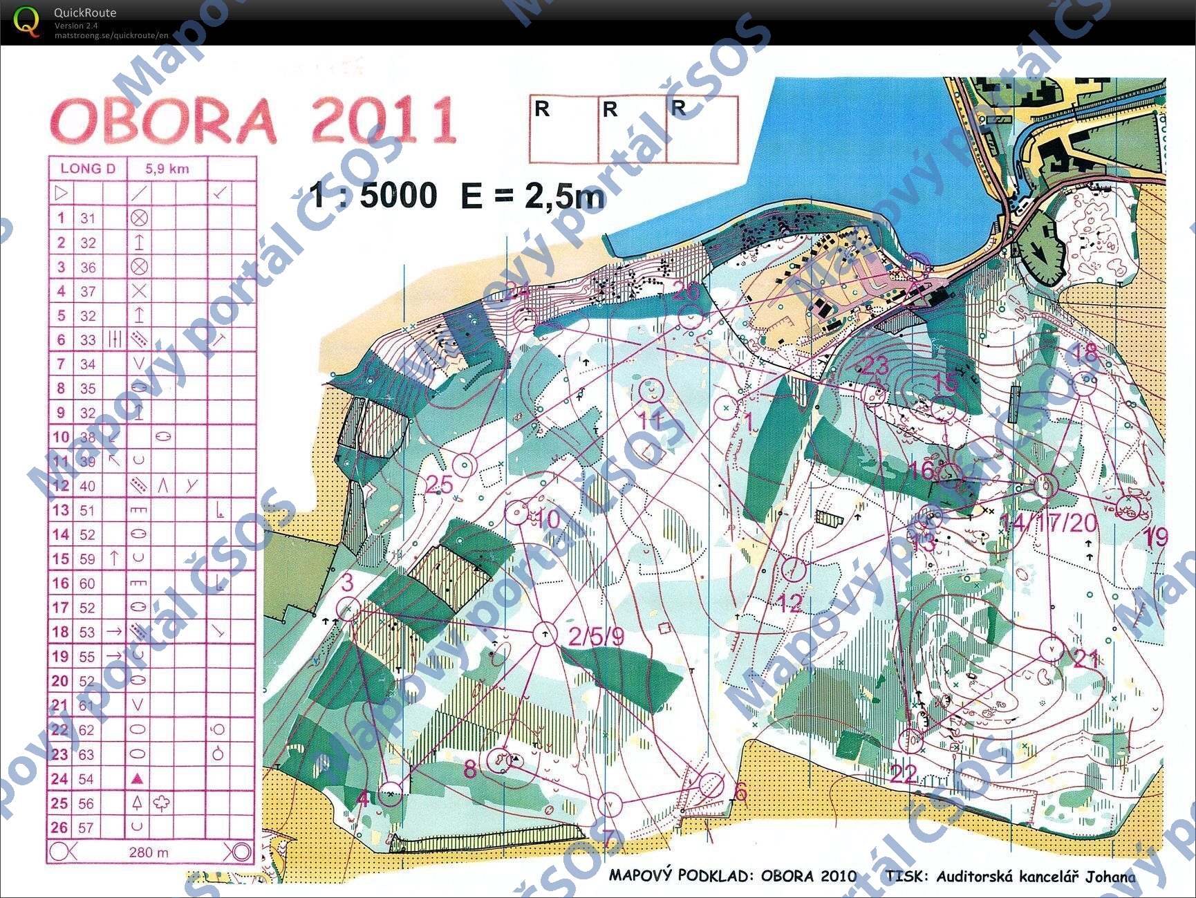
Map Obora 2011
Basic map data
| Scale |
1:5000 |
Equidistance |
2.5m |
Sport |
Foot-O
|
Specification |
ISOM (foot-O)
|
| Year |
2011
|
Published by |
- |
Filing number |
|
| Blocking until |
0 |
Blocking reason |
|
| Map admin |
-
|
Publisher |
JPV - Oddíl OS SK Prostějov
|
Educational map |
ne |
| Locality |
Plumlov |
Kraj |
Olomoucký kraj |
Area size |
0.961 km2
|
| Based on |
OB mapa Obora 2005 |
Stav |
- |
Drawing technique |
OCAD
|
| Printed in |
. |
Print technique |
laser
|
| Note (public) |
Jen JPG. Mapa Obora 2010 (Id 5862) bez cest, hranice kresby mírně upravené. |
| Entry created by |
Zdeněk Lenhart |
Archive |
c--0 |
ID/status |
14490 / archived |
Autoři
Obrys mapy
Náhled
Using the map without publisher's permission for organized events is copyright piracy. Please contact the map administrator listed in the Map Archive database and obtain maps in full quality for printing.