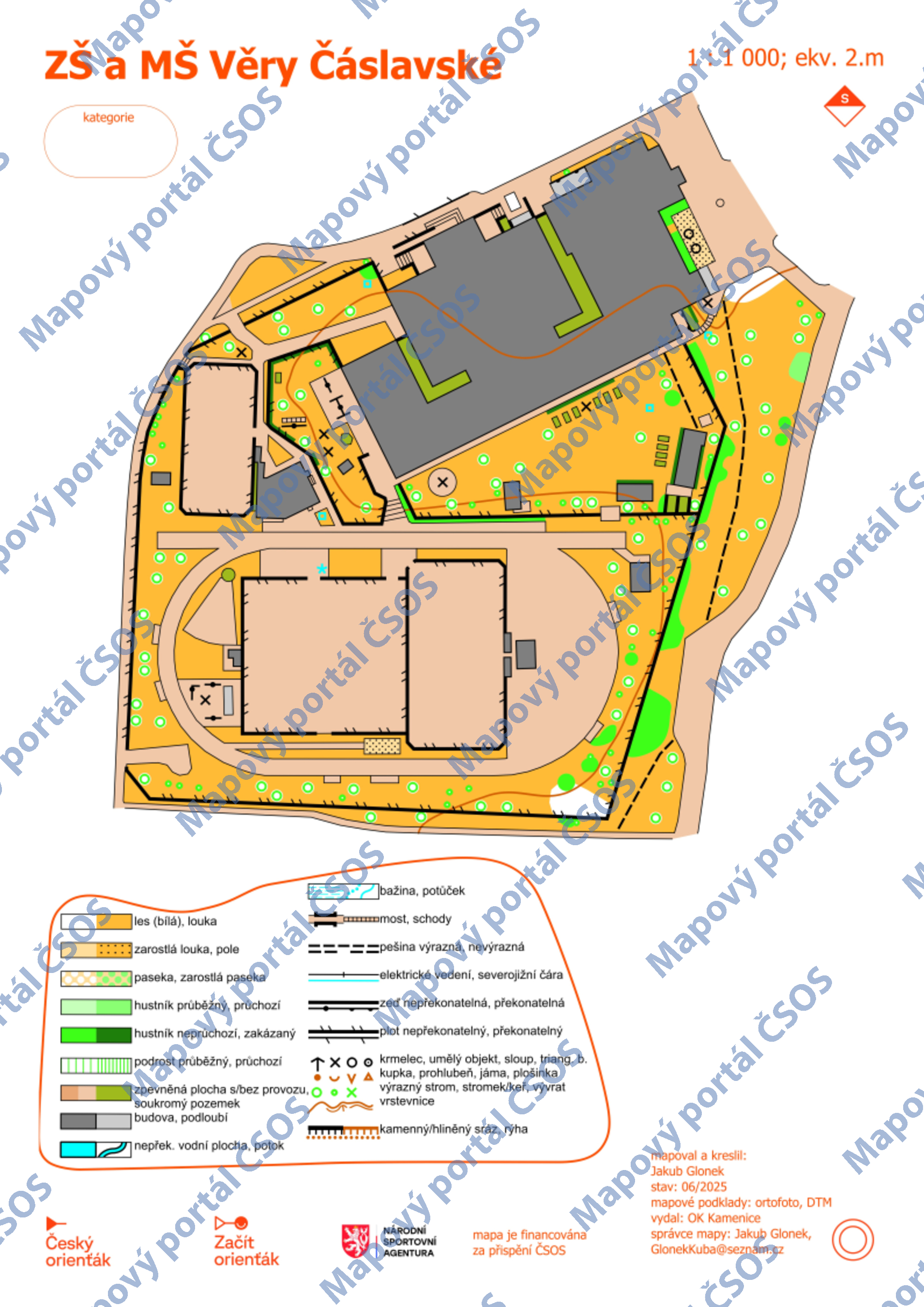
Map ZŠ a MŠ Věry Čáslavské
Basic map data
| Scale |
1:1000 |
Equidistance |
2.0m |
Sport |
Foot-O/print
|
Specification |
ISSprOM (sprint foot-O)
|
| Year |
2025
|
Published by |
OK Kamenice |
Filing number |
|
| Blocking until |
|
Blocking reason |
|
| Map admin |
Jakub Glonek
|
Publisher |
|
Educational map |
ano |
| Locality |
Praha - Petřiny |
Kraj |
Praha |
Area size |
0.023 km2
|
| Based on |
ortofoto, DTM, OB |
Stav |
2025-06 |
Drawing technique |
OO-mapper
|
| Printed in |
|
Print technique |
|
| Entry created by |
Jakub Glonek |
Archive |
Do Archivu nebyly dodány papírové výtisky.
|
ID/status |
14078 / not filed |
Autoři
Obrys mapy
Náhled
Using the map without publisher's permission for organized events is copyright piracy. Please contact the map administrator listed in the Map Archive database and obtain maps in full quality for printing.