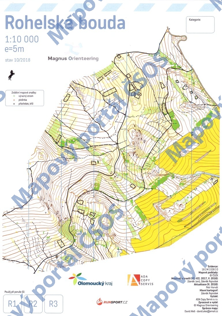
Map Rohelská bouda
Basic map data
| Scale |
1:10000 |
Equidistance |
5.0m |
Sport |
Foot-O
|
Specification |
ISOM (foot-O)
|
| Year |
2018
|
Published by |
Magnus Orienteering |
Filing number |
18M028O |
| Blocking until |
2027 |
Blocking reason |
|
| Map admin |
David Aleš
|
Publisher |
ASU - Magnus Orienteering
|
Educational map |
ne |
| Locality |
Strupšín (Zábřeh 9v) |
Kraj |
Olomoucký kraj |
Area size |
2.924 km2
|
| Based on |
ČÚZK |
Stav |
2018-10 |
Drawing technique |
OCAD 11
|
| Printed in |
ADA Copy Servis s.r.o. |
Print technique |
laser
|
|
Main race (title)
|
Oblastní žebříček
|
Main race (date) |
2018-11-03 |
| Entry created by |
Štěpán Hrobař |
Archive |
aaa0 |
ID/status |
10017 / archived |
Autoři
Obrys mapy
Náhled
Using the map without publisher's permission for organized events is copyright piracy. Please contact the map administrator listed in the Map Archive database and obtain maps in full quality for printing.